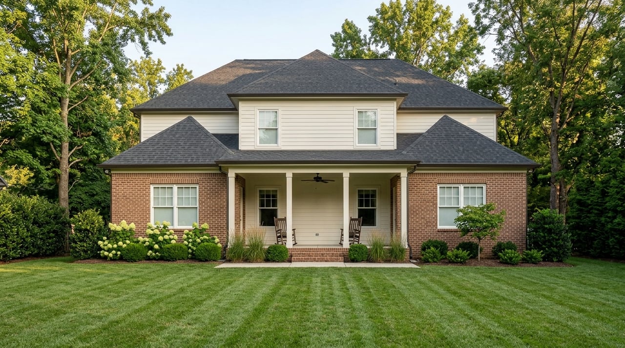
Thinking about moving to Aurora but not sure which part fits your day-to-day routine? In this Fox River city, life feels different depending on the corridor you call home, from walkable arts downtown to Route 59’s every-convenience clusters. If you understand how each area works, you can choose a home that matches your commute, shopping habits, and downtime. In this guide, you’ll learn what everyday life looks like across Aurora’s major corridors and how to sample each one before you decide. Let’s dive in.
How Aurora’s corridors shape daily life
Aurora stretches across the Fox River with areas locals often describe as west side, east side, and far east side. That split shapes where you shop, how you commute, and which parks and venues you use most. Downtown centers around the riverfront, while the Route 59 and I‑88 corridors focus on shopping and easy highway access. To the north and west, the Randall Road corridor links many suburbs, including parts of Elgin, creating a long spine of retail and services.
For a deeper city overview and history, you can browse Aurora’s profile on Wikipedia. Below, you’ll find the practical view: what it feels like to live your life in each corridor.
Downtown and riverfront: Walkable arts and river time
If you love culture within steps of your front door, start here. Downtown’s streets around Stolp Island, Broadway, and Galena Boulevard mix historic architecture with cafes and local restaurants. On event days, the area buzzes with shows and concerts, then settles into a calmer pace in the mornings.
Two anchors set the tone. The Paramount Theatre delivers a year-round Broadway-style slate, and RiverEdge Park hosts outdoor concerts and seasonal festivals nearby. Apartment living and older single-family homes make it easy to walk to dinner, a show, and the riverwalk. Expect a pedestrian-friendly pocket, with most daily errands still within a short drive to larger stores outside the core.
East/Fox Valley corridor: Everyday convenience near Route 59
East New York Street and Route 59 form a classic suburban retail spine. You’ll find big-box shopping, chain dining, entertainment, and plenty of parking. Streets are designed for cars, traffic lights are frequent, and most errands are a quick drive.
The Fox Valley Mall area and adjacent plazas create an all-in-one convenience hub. To see the scale of retail nearby, check listings for the Fox Valley area, such as this retail cluster on E. New York Street. Housing tends to be newer and includes subdivisions, townhomes, and apartments, which suits people who want quick shopping access and direct routes to Route 59.
I‑88 and Chicago Premium Outlets: Highway access and regional draws
Along I‑88 near Farnsworth Avenue, you get instant highway access and a regional retail focus. Many people who travel by car for work or weekend day trips like how fast they can reach neighboring suburbs. The area also attracts non-residents for shopping and has hospitality jobs nearby.
The Chicago Premium Outlets is the signature destination. Weekday traffic ebbs and flows with retail hours, and the streets are designed for drivers. If your routine includes frequent highway trips, this corridor puts you on the road fast.
Randall Road and the Elgin–Batavia corridor: Big spine of services
Randall Road is a long, multi-community corridor that links restaurants, big-box stores, medical offices, and business parks across the western suburbs. Traffic is heavier, and most stops are a short drive apart. If you work in retail, medical, or office campuses along this route, living nearby can simplify your commute.
Kane County has highlighted planned bike, pedestrian, and transit improvements along Randall because of its scale and vehicle volumes. You can explore the county’s efforts on the Randall Road Multimodal site. Day to day, expect a car-first environment with easy access to services across several towns, including parts of Elgin.
Phillips Park and quieter residential pockets: Park-first living
If you want a tucked-away feel with easy green space, look at the residential blocks around Phillips Park. Streets are calmer, yards are common, and weekend mornings often start with a walk under mature trees. This area suits people who want parks, golf, and neighborhood events close to home.
Phillips Park includes a visitor center, historic displays, a golf course, a sunken garden, and a small, free zoo. City services also support pavilion rentals and family programming. Get details and hours from the city’s Phillips Park page, and explore broader trail and park connections in the city’s Recreation and Amenities guide.
Getting around: Trains, roads, and parking
Commuters to Chicago rely on Metra’s BNSF Line, which terminates at the Aurora Transportation Center. Trip times to downtown Chicago often fall in the roughly one-hour range depending on the train. Station details and connecting options are listed on the Aurora Metra station profile.
If you live near Route 59, the Route 59 stop on the same line is a key anchor for rail commuters on the Naperville–Aurora border. You can review parking, bus links, and schedules at the Route 59 station page. Drivers use I‑88 for east–west trips, with local corridors like Route 59, Ogden Avenue, and Randall Road feeding highway ramps and retail nodes. In the retail-heavy areas, large parking lots and park-and-ride options are part of everyday life.
Which corridor fits your lifestyle?
- You want walkable arts and dining: Choose the Downtown/Riverfront area near the Paramount and riverwalk.
- You want fast errands and big-box access: Look along the East/Fox Valley corridor near Route 59 and E. New York Street.
- You need fast highway access or enjoy outlet shopping: Consider the I‑88/Premium Outlets area near Farnsworth.
- You work along a major services spine: The Randall Road corridor puts retail, medical, and office nodes within easy reach.
- You prefer quiet streets and green space: Phillips Park–adjacent pockets offer a park-first rhythm and established homes.
One-day sampler itineraries
Want to test-drive a corridor before you commit? Use these simple itineraries to get the feel of daily life.
Downtown day: culture and the river
- Morning coffee, then a short stroll along the riverwalk.
- Lunch near the theater district.
- Evening show at the Paramount Theatre or a seasonal event at RiverEdge Park.
East/Fox Valley day: easy errands and dinner
- Midday supply run at the Fox Valley Mall area and nearby plazas like E. New York Street retail clusters.
- Late afternoon matinee or bowling with friends.
- Family dinner at a nearby restaurant with plenty of parking.
Park-first day: fresh air and calm streets
- Morning walk and picnic at Phillips Park with a stop at the small, free zoo and sunken garden. See details on the city’s Phillips Park page.
- Afternoon golf or playground time.
- Easy, low-traffic drive home through tree-lined residential blocks.
Making a confident move
Every corridor in Aurora offers a different rhythm, from downtown’s show nights to Route 59’s errand runs and the park-first calm around Phillips Park. If you match your home search to your daily routine and commute needs, your move feels smoother from day one. When you are ready to narrow your options or compare neighborhoods, reach out for local guidance and a clear plan.
If you want a tailored search, a fast sale, or relocation support, connect with Jeff Stainer for expert, local help. Get your free home valuation and a step-by-step plan that fits your timeline.
FAQs
Is Aurora commute-friendly to downtown Chicago?
- Yes. Metra’s BNSF Line serves the city at the Aurora station and Route 59, with travel times to downtown Chicago commonly in the roughly one-hour range on many weekday trains.
Where in Aurora can I live near arts and walkable dining?
- The Downtown/Riverfront area around Broadway, Galena Boulevard, and Stolp Island clusters venues like the Paramount Theatre along with cafes and restaurants.
What are Aurora’s biggest shopping areas for daily errands?
- The Fox Valley Mall and E. New York Street corridor concentrate big-box stores and services, while the Chicago Premium Outlets off I‑88 draw regional shoppers.
What is the Randall Road corridor like day to day?
- It is a long, auto-oriented services spine with heavy traffic, national retailers, and medical and office nodes; planned bike and pedestrian upgrades are outlined on the Randall Road Multimodal site.
What makes the Phillips Park area appealing for residents?
- Quieter streets, established single-family homes, and easy access to Phillips Park’s visitor center, golf, sunken garden, and small free zoo, which you can preview on the city’s Phillips Park page.